Showing posts with label NASA. Show all posts

Monday, June 29, 2015

Book Review: PostGIS Essentials

I decided to teach myself PostGIS/PostgreSQL.  The other option was returning to GeoServer, which I started last summer, but I will leave the latter for the fall.

After shopping around and reading reader reviews, I purchased PostGIS Essentials, April 2015 by Angel Marquez. I got a Kindle copy which was $22 on Amazon.  Overall, I recommend it for those, like me, who want to learn PostGIS as a beginner. Having even a little SQL knowledge is also very helpful.  However, the later chapters are for much more advanced users and developing web and desktop applications.

The book covers downloading and installing PostGIS and gives a good quick background on its uses. Next, it illustrates three ways to create a spatial database using: 1) the command prompt, 2) the toolbars or GUI in PostGIS, and 3) a SQL script.  

A great way to learn PostGIS/PostgreSQL
Before covering how to insert data into these tables, the book goes into discussion of projections and how to include these in spatial tables.  It then shows how to manually add this information and also extract it from shapefiles and import it into PostGIS.

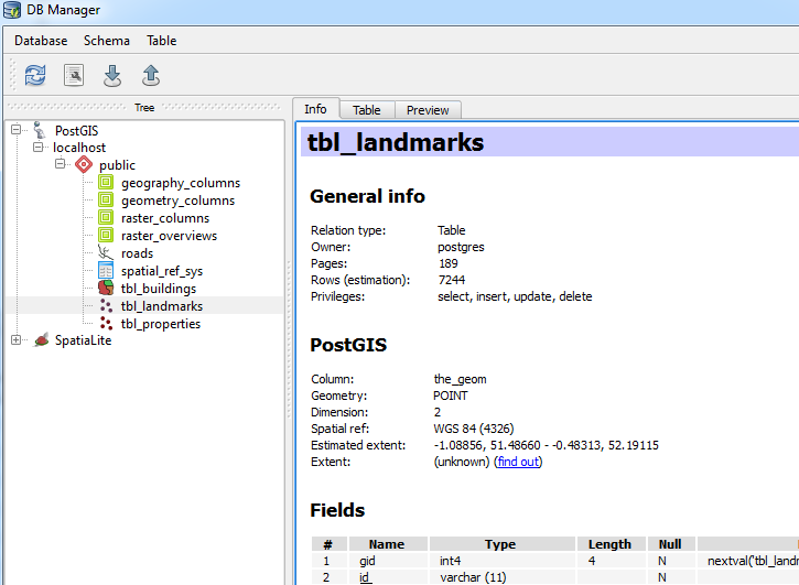
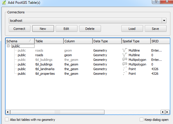
Next, we get down to business with creating non-spatial and spatial queries/functions and accessing information from more than one database.  Of course, connecting to PostGIS databases in QGIS is also covered as well as doing spatial queries in QGIS using PostGIS using DB Manager toolbar in QGIS.
Going from PostGIS to QGIS is a snap!
Using DB Manager from the database toolbar in QGIS.

You will also find information on GDAL, working with raster files.  The last few chapters cover advanced features including performance tuning and spatial indexes, developing web and desktop GIS applications.  The latter uses NASA World Wind.  (Note: I have only had time to skim these chapters.)

A few quick pointers

  • Early on the book assumes the reader knows where to execute SQL queries..If you are a novice like me it takes a minute to realize it is the magnifying glass 
  • ...and how to switch to a different database table when running code on several different ones. 

  • Be sure to check the column names in data from OpenStreetMap, particularly the id column: osm_id vs. id.
Overall, the book is a great resource to have. Like all of Packt's books the code is available to download on their website, or you can type it in yourself, which is my preference.

Disclosures
I bought the copy of this book on my own.  I served as a reviewer for another Packt publication.

Thursday, March 13, 2014

An Epic View with NASA's Worldview

In an ever-changing world, having a global view is extremely important.  NASA has developed several website/tools where you can view and download up-to-date global remote sensing data.  NASA's Worldview is one of them.  If you are looking for a quick example of its practical value, take a look at last fall's forest fires in the western U.S.
 "Most of the 100+ available products are updated within three hours of observation, essentially showing the entire Earth as it looks 'right now'. This supports time-critical application areas such as wildfire management, air quality measurements, and flood monitoring."- NASA Worldview Website
Of note, browsing on a tablet or smartphone is supported.  There is a layered slider for time, so users can choose the year, month, and day. Selecting dates in some websites can be painful.  However, this slider is intuitive, quick, and easy to use--much more so than those pesky calendar pages some users are forced to navigate.  Users also have several base maps to choose from in addition to the rest of the layers.  There is a great "About" page and brief "Tour" available.

Global Land Surface Temperatures/Day from MODIS, 17 July 2013
A few basic social features are built-in.  The website has buttons for saving links to certain views and taking screenshots.  There are lot of different instruments and views but everything is well-labeled. A few different band combinations can be selected with one-click for easy viewing.  This is especially important for looking at vegetation and agriculture, for example. 

You can also check out recent scenes from Landsat 7 at: http://earthnow.usgs.gov/ or Landsat 8 at: http://landsatlook.usgs.gov/.  If you are interested in NASA's open data policies, a quick overview can be found at: http://science.nasa.gov/earth-science/earth-science-data/data-information-policy/

Wednesday, August 8, 2012

Remote Sensing and GIS That Are Out of This World!


Image: NASA/JPL/University of Arizona "Serpent Dust Devil of Mars"

It is easy to forget a lot of remote and direct sensing, GIS and GPS work, and measurements are not even done on Earth.  Of course, I am referring to NASA's Curiosity Rover that touched down this week and the Mars Reconnaissance Orbiter (MRO) which has been in orbit for several years.  These are following in the footsteps of other great rovers and spacecraft that have successfully made the voyage.  However, I feel like the MRO is a bit neglected...

The MRO carries a host of sensors and instruments to map and image Mars including, A high-resolution camera in visible wavelengths (HiRISE), a wide area view camera, a weather imager in five visible and two ultraviolet bands (MARCI), an infrared spectrometer looking for signs of water, mineral deposits, etc., a radiometer, and a radar (SHARAD).

The scientific value of these instruments is beyond measure. NASA is probably one of the best agencies at making data and images available publically...Here are some neat open source resources related to this endeavour!