Showing posts with label open source. Show all posts

Monday, March 16, 2015

Businesses Based on Open Source GIS

Businesses based on free and open source GIS software (FOSS GIS) offer a number of opportunities to owners and clients alike.  Like Red Hat and Linux, these companies offer several services using FOSS GIS.  At least two have their own suite or development tools (Boundless OpenGeo Suite and Cartologic's Cartoview).  These services include: consulting, development, training (sometimes certification/testing), and support.

Of course, these businesses also offer job opportunities 
for those interested in FOSS GIS! 

In today's post, we will look at a sample of companies out there, where they are based, their philosophy, and specific areas of interest.  All businesses that I reviewed offer sample or demo web maps and apps on their websites.  Although the companies are based around the world, they all offer services to clients whether near or far.

New York-based Boundless is the biggest company out there with 45 employees and venture capital financing.  It has its own suite of software OpenGeo Suite and emphasizes interoperability of different combinations of open and paid-software.  Boundless has a big list of big name clients across different sectors.


This same philosophy that GIS tools can come from different realms is also shared by Cartologic based on Giza, Egypt.  They are a team of geospatial IT developers and focus on Business Integration, GIS Mobile Applications, and GeoPortals.  Cartologic offers the free Cartoview an open source web platform for publishing maps.  (I will cover Cartoview in a later post.)
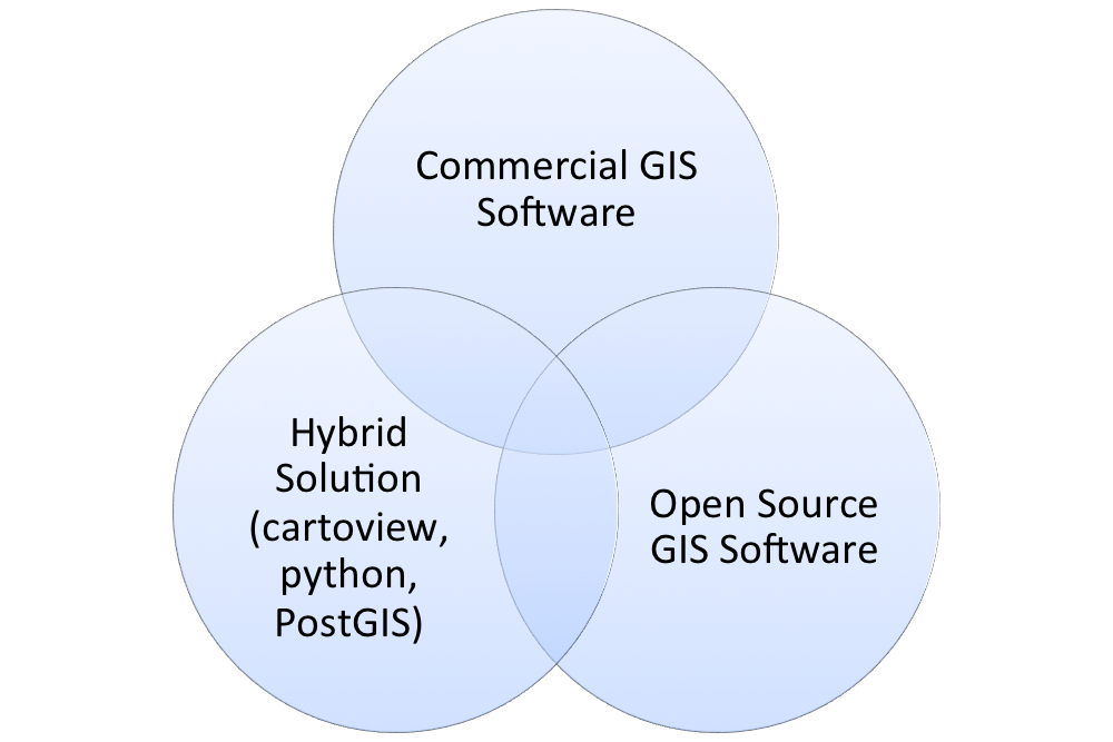
Many businesses recognize that a client's needs
can be met in more than one way, as this diagram
from Cartologic illustrates.
South Africa-based Kartoza was formed as a merger between Linfiniti Consulting (Tim Sutton) and Afrispatial in 2014. Kartoza's key business areas are: Training and Education, Deployment and Support, and Software Development. Kartoza is also a Boundless partner for Southern Africa.

The UK-based Lutra Consulting specializes in flood risk.  Like many of these, businesses, they have given back to the open source community--especially through the creation of QGIS plugins, like AutoTrace.  They are currently crowd funding for AutoTrace 2.

gvSIG Association (SIG is Spanish for GIS or un sistema de informacion geografica).  gvSIG moved from a DOT.org to a DOT.com.  It is located in Valencia, Spain and  is based off of the free desktop and mobile platforms of gvSIG.

The Association raises a new business model around Free Software democratic values, 
based on cooperation and shared knowledge, where part of the generated benefit 
reverts on the strengthening of the gvSIG project. 

NaturalGIS, based in Evora, Portugal, utilizes QGIS and PostGIS/PostgreSQL features services including:  Consulting, Web Development, Training, Data Analysis, Support, and Development.
Many businesses, like NaturalGIS, use QGIS as the go-to replacement for ArcGIS.
Businesses that offer commercial support for QGIS:
http://www2.qgis.org/en/site/forusers/commercial_support.html

Contact me
If you are a business based on open source GIS software, I want to hear more about you!  Please leave a link and a little about you in the comment section below.  I am thinking about compiling a list of different companies.
Thursday, August 14, 2014

Image Processing Using Orfeo Toolbox in QGIS

Satellite and aerial images are more than pretty pictures.  Each image contains a wealth of data that can be queried, modified, extracted, and visualized through simple and advanced techniques.  This blog entry will cover a few basic tools in the Orfeo Toolbox in QGIS.  Instructions for installing Orfeo Toolbox in the QGIS processing toolbox can be found be clicking here.  There is also a standalone Monteverdi 2 program.

Quick Background on Orfeo Toolbox
The toolbox, often abbreviated OTB, was created to promote the use of several French satellites.  Like many programs, the algorithms are geared towards popular satellites.  For more on its creation, visit: http://www.orfeo-toolbox.org/otb/about-otb.html.

In QGIS
After following the instructions above, go under "Processing" and make sure the "Toolbox" is selected. You will see Orfeo's tools grouped into what types of functions they perform.

Screenshot of Orfeo Toolbox in QGIS's Processing Toolbox
Feature Extraction, Identification, and Classification
Extracting features from imagery is an extremely powerful tool.  For example, roads can be extracted from imagery.  Edges of images and line segments can be detected.  They can a provide a quick unique source of data for areas large and small.  Click on any of the images below to get a closer look.

Extracted edges of buildings at a college campus.

Line segment detection: In this case the lines of a tennis court (and fencing).
The tan lines are generated by the software.
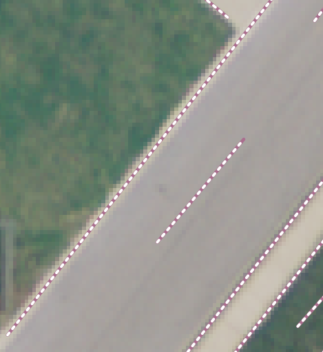
Line segments differentiating a road, sidewalk, and  nearby grass.
Images can also be searched for specific objects. to automate their discovery. Image classification, groupings based on spectral characteristics, whether supervised or unsupervised, is another post in itself.

Change Detection
Another important aspect of imagery is detecting changes over time, whether something is new, absent, modified, or (re)moved.

Left: Unpainted roof, Center: Roof painted red, Right: Change Detection of Roof
Documentation
Remote sensing and image processing are technical fields.  There is a significant amount of documentation (hundreds of pages) on the Orfeo Toolbox website. A shortened manual and a series of short practical exercises could help to expand its user base.  If you work in remote sensing and image processing, be sure to check out this fantastic resource!