LIDAR is an important technology that is undergoing continuous and expansive growth and predicted to reach $1 billion by 2020. A recent report also describes ongoing developments in LIDAR in Europe. NOAA has a great one-hour Introduction to LIDAR that I recommend checking out: http://coast.noaa.gov/digitalcoast/training/intro-lidar
 |
| Source: Allied Market Research, https://www.alliedmarketresearch.com/lidar-market |
Linking LAStools with QGIS
Linking the two has gotten much simpler since QGIS 2.4. Simply download the *.zip file from: http://lastools.org/download/lastools.zip. Unzip the file, and copy and past the LAStools folder into a simple directory like "c:/" If you have QGIS running, close it before proceeding.
Tip #1: Users often copy the folder to a folder pathway that is complex and includes spaces like c:/Program Files/ or c:/My Documents. It will not work. Again, use simple path names, no spaces!
Tip #2: This also applies for any files you import with LAStools or export during processing in QGIS.
After doing this, start QGIS, go to the Processing Toolbar, click "Tools for LiDAR Data"->Activate-> and enter or browse to the folder pathway. I've been using LAStools with the most recent version of QGIS (2.10) and have not had any problems yet.
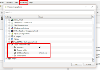 |
| Linking LAStools and QGIS has gotten much easier! |
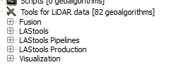 |
| Expand and see a wide range of tools at your disposal! Note: The LAStools Production or PRO tools are for batch processing. |
Tip #3: If you run a tool and nothing happens, be sure that NONE of the folder pathways, for importing data and exporting results, are complex and/or contain spaces.
Tip #4: Be sure to read the "Log" for important information and troubleshooting.
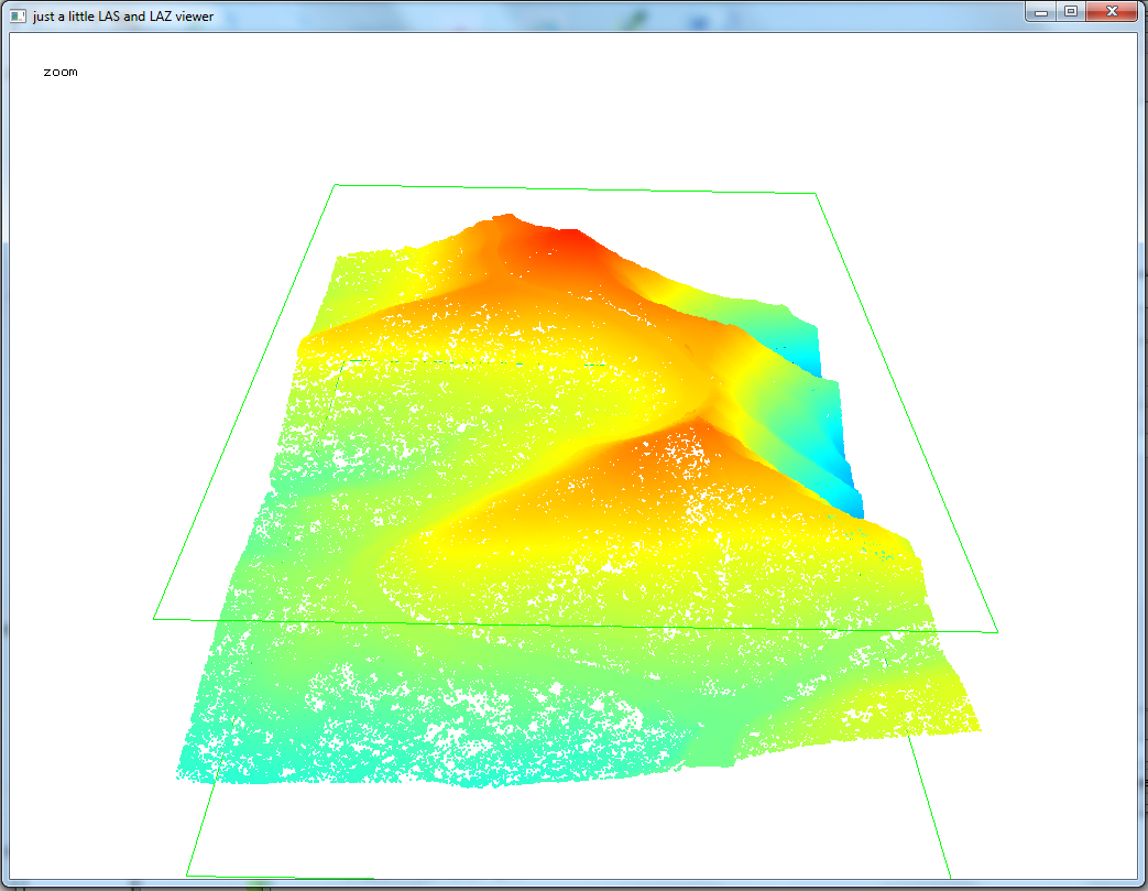
Tip #5: When using lasview in QGIS, pressing Space bar changes your ability to navigate from zoom, tilt,pan, and translate. In the upper-left of the window, you will see the navigation type change as you press it.
Furthermore, right-clicking the mouse, brings up a menu for changing the view of LIDAR, from selecting returns, how to symbolize/color data.
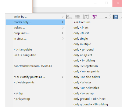 |
| The right click menu in LAStools |
Tip #6: To get a 3D view, press Space bar until Pan is displayed, if is not already. Click and hold your mouse, then move it up to the top of the screen and voila!
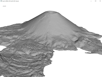 |
| Wizard Island, Crater Lake, Oregon, Data from: Open Topography. lasnoise was also used. |
OpenTopography
Digital Coast
3D Elevation Program
Google search for "County lidar" and State LIDAR


