Maps play a vital role in communicating location-based weather-related risks. A lot of web-based weather maps and and apps are out there. I won't dare creating a list, since I will probably miss your favorite. A quick Google search even reveals OpenWeatherMap.org complete with an API.
The National Weather Service (NWS) has several different open web-based mapping options. Most recently, I stumbled upon their ESRI-based app:NWS Enhanced Data Display. Since it is a simple, easy-to-use well designed app, it is worth a blog post! Click on the image below to magnify the screenshot. It is an improvement over other NWS products and similar maps out on the web, because it is designed with the user(s) in mind.
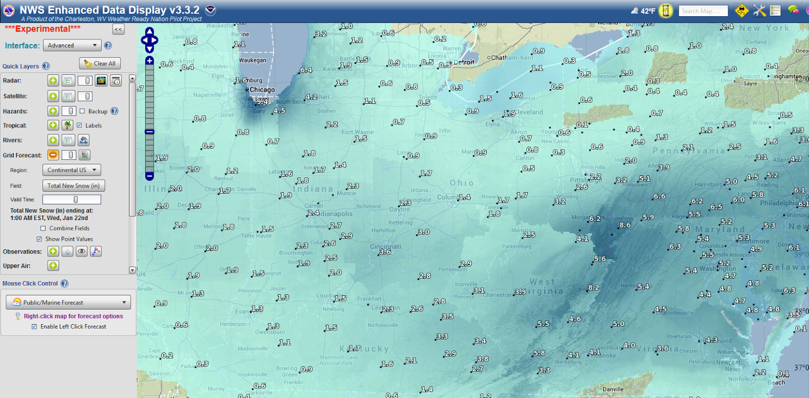 |
| The NWS Enhanced Data Display - Snow Predictions |
Clicking on individual weather stations, or searching for one, brings up all the needed forecasts and hourly graphs. Users can also add their own map files and draw polygons to get forecasts for specific regions, which may cross several state boundaries. There are also some basic storm-tracking/analytical functions such as a storm's time of arrival. Lastly, when a user is done, they can even share the map by clicking a "Save/Share" button at the bottom of the screen. A small url is generated and can be shared.
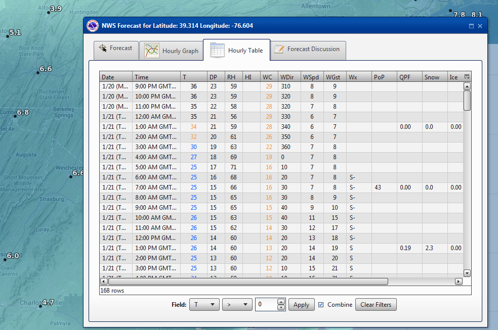 |
| Hour-by-Hour Predictions... |
Also check out:
NWS GIS Data Portal
NWS Aware Report
No comments:
Post a Comment