Naming, organizing, and accessing files during any type of analysis or project is always a challenge. The most
recent release of QGIS features a file browser to help create and manage different types of geospatial data and is akin to ArcCatalog. After installing QGIS, you will notice a second yellow "Q" icon--this is the shortcut to the browser.
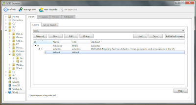
In the example below, you will see a connection made to USGS Web Map Service (WMS) through the QGIS browser.
 |
| Finally, a way to organize all of these open GIS files! |
The browser can also be docked to QGIS so there is no need to re-open and close any windows.

No comments:
Post a Comment